Rosengarten Schlern Skymarathon: Registration plus
The third edition of Rosengarten Schlern Skymarathon will take place on July 13th and does register an increase of 100 runners compared to the same period last year.
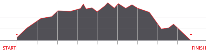
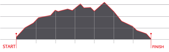
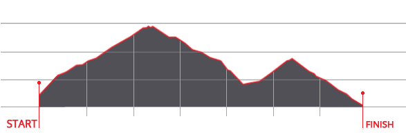
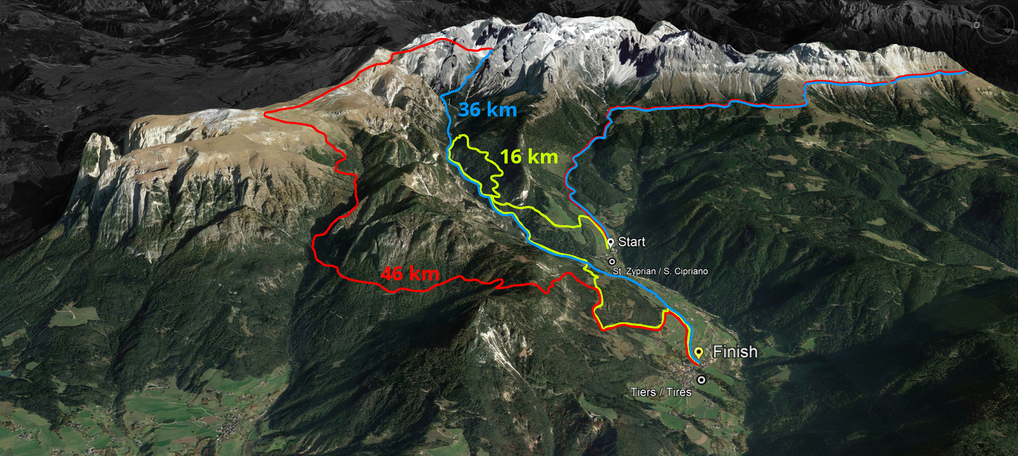
Half of the 500 places have already been allocated and as experience has shown that the local runners register late, the organizers advise not to wait too long to secure one of the 500 starting places. At this trail run in a unique scenery you can choose between two routes: 45 kilometres with 3,000 metres of altitude difference completely asphalt-free or 36 kilometres with 2,000 metres of altitude difference.
Last year's winners in the men's competition, Ludwig Andres and Andreas Reiterer, will be back at the start in 2019 and will try to defend their title. In the women's event, defending champion Anna Pedevilla makes it dependent on her physical condition whether she can compete in Tiers or not, as she will be taking part in an ultramarathon the week before.
"Thanks to the cooperation of numerous volunteers and the support of sponsors from the local business community, we are once again hosting running enthusiasts from all over Europe in Tiers on the second weekend in July," says Bernhard Rieder, OC manager of the Rosengarten Schlern Skymarathon. Runners from Italy, Austria, Switzerland, Germany, the Netherlands, France, Great Britain, the Czech Republic, Slovakia and Norway are currently registered. For the first time a week before the race the complete range of Dynafit running shoes can be tested free of charge in cooperation with the event's main sponsor.
All information about this trail run supported by Dynafit can be found at www.skymarathontiers.it